Priorities
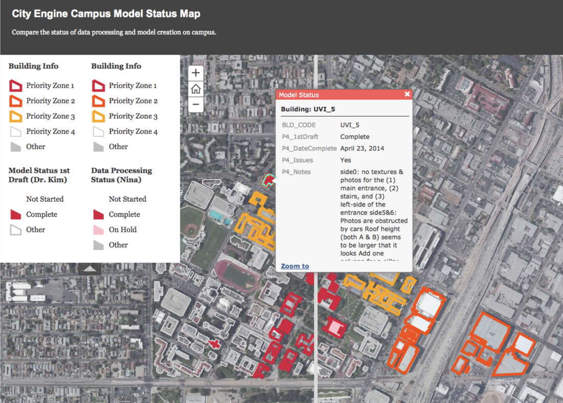
Priority map
There are 152 buildings to model. We will prioritize them using the following criteria:
I. Priority zones specified by FMS
We will attempt to complete ALL buildings within Zone 1 before beginning buildings within Zone 2.
II. Data Availability & Building Complexity
Within each priority zone, we will prioritize buildings that have the lowest Total Score. These buildings have the most data available (AutoCAD files and elevation PDFs) and the least complexity.
I. Priority zones specified by FMS
We will attempt to complete ALL buildings within Zone 1 before beginning buildings within Zone 2.
- Zone 1) Buildings along Trousdale Parkway.
- Zone 2) University Village and East of Figuera St.
- Zone 3) Buildings Along Major Campus Roads
- Zone 4) All Other Buildings within Study Area.
II. Data Availability & Building Complexity
Within each priority zone, we will prioritize buildings that have the lowest Total Score. These buildings have the most data available (AutoCAD files and elevation PDFs) and the least complexity.
- Total Score = Building Score * Data Score
- Building Score = F * C, where: F = Number of Floors and C = Complexity Rating (easy=1, medium=2, hard=6).
- Data Score = H * X, where: H = Height Information (easy - have PDF=1, medium - other=2, hard - PDF missing=3) and X = XY Location (easy - AutoCAD correct=1, medium - Need to Fix AutoCAD=2, hard - AutoCAD missing=3)
